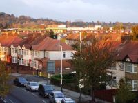
Perivale (/ˈpɛrɪˌveɪl/) is an area of Greater London, 9.5 miles (15.3 km) west of Charing Cross. It is the smallest of the seven towns which make up the London Borough of Ealing.
Perivale is mostly residential, with a library, community centre, a number of parks and open spaces, as well as a large industrial estate. Landmarks include the grade II* listed Art Deco Hoover Building, as well as St Mary's Church (c. 12th century), Horsenden Hill park and Perivale Wood Local Nature Reserve run by the Selborne Society. Perivale forms part of the UB6 postcode area, along with Greenford.
History
Origins and early history
Historically it was a parish in the hundred of Elthorne, in the county of Middlesex. Perivale was one of the county's smallest parishes up until the early twentieth century, at just 633 acres (256 hectares) and a negligible population.
The church of St Mary's, Perivale is one of London's oldest churches. Dating to at least the early thirteenth century, the church still stands today (south of the A40, off Perivale Lane). The neighbouring fifteenth century Rectory House was demolished in 1958. Perivale was a farming area from at least the fourteenth century. At this date, Perivale consisted of woodland and fields used for arable farming.
During the fifteenth century, a grand, three-story manor house Perivale Manor was commissioned by Henry Myllett, a prominent Perivale resident. The house was surrounded by a moat, gardens orchards and outbuildings. Perivale Manor, located close to St Mary's Church was demolished at some point around 1784.
From the sixteenth century, wheat was the main crop of Perivale, a crop for which it gained a high reputation. With industrialisation, much of Perivale's land began to be used to grow grass for hay to feed London's horses. The building of the Paddington Branch of the Grand Union Canal in 1801 (which still runs through Perivale today) led to a high demand for Perivale's hay. By 1839, alm
